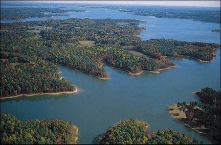
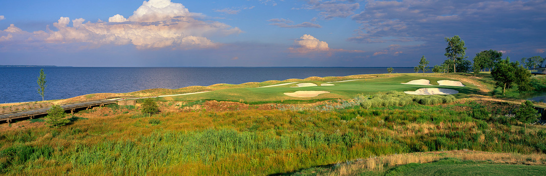
 Kerr Lake Reservoir / Buggs Island Lake, NC and VA border
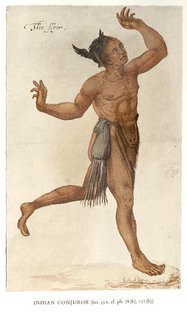 "The Conjurer" by John White, 1586. Coastal Algonkian medicine man with his medicine bag and bird symbol of office. Last time, I said I would explore the lifeways of the Occaneechi Tribe, but before I do, I want to offer some observations on the illness that ravaged the Coastal Algonkians following the first visits of the English, and created the first real war between the English and the Natives, namely, Pemisapan's War. "Twise this Wiroans named Wingina [later Pemisapan] was so grieviously sicke that hee was like to die, and as he lay languishing, doubting of any helpe by his own priestes, and thinking he was in such danger for offending us, and thereby our God, sent for some of us to pray . . . . the people began to die very fast, and many in short space, in some townes about twentie, and in some fourtie, and in one sixe score [120] , which in trueth was very many in respect of their numbers. . . .The disease also so strange, that they neither knew what it was, nor how to cure it . . . . [yet] all the space of their sickenes, there was no man of ours known to die, or that was specially sicke," from A Brief and True Report of the New Found Land of Virginia, by Thomas Hariot, 1588.
Despite the terrible death toll, the chief Wingina did survive, but his beloved brother, Granganimeo, and many of his people, succumbed. Vowing revenge, Wingina changed his name to Pemisapan and assembled an alliance of Algonkian tribes -- Roanoak, Mangoak, and Chowanoak -- to totally destroy the English explorers in the summer of 1586. However, the plot was revealed to Ralph Lane by Skiko, the son of the Chowanoak chief, who remained friendly to the English and seemed reluctant to oppose them openly, even if some of his people chose to join the alliance. The raid on the English explorers encamped on Roanoke thus failed to surprise them, and in the battle, Wingina/Pemisapan was killed. The rest of the alliance melted back into their home villages, but clearly the desire to defend their people against mysterious foreign disease did not die with Pemisapan. His war again flared to life when another group of English, this time colonists with women and children, entered coastal North Carolina just one year later. The mysterious disease that killed so many Natives, yet hardly showed any symptoms of illness among the English, could not be measles or smallpox -- two diseases that did ravage Native populations in other places, but have a very short time of transmission, and must be spread to another person during the infectious phase of the sickness. Given that the disease spread rapidly in close quarters, but with no signs of serious illness from the transmitting person or persons, it had to be a disease that can be carried and spread by otherwise healthy humans. Influenza fits the description perfectly, as it can be asymptomatic, a fact which is not widely understood. According to an article published by the National Institutes of Health in 2009, "One in three influenza-infected individuals is asymptomatic." Influenza could ravage the Native populations because they had zero immunity to any form of the virus, unlike European populations regularly exposed to some form of influenza from infancy. It has been theorized that Europeans carried so many new diseases to the Americas because they had domesticated such a variety of animals -- chickens, pigs, cattle -- and lived with them in close proximity, often in the same structure, during the Middle Ages. The modern version of flu, avian flu, can also produce asymptomatic carriers, especially in persons who frequently handle live poultry, as in the case of one Chinese worker tested in January, 2014. Native Americans frequently ate meat, but primarily wild caught game, and had no exposure to diseases transmitted by domestic animals or rats, namely, influenza, measles, smallpox, and bubonic plague. These 4 diseases accounted for the highest numbers of deaths among Native populations in the years following European contact. Thus, I suggest that it is not animal protein itself that is the source of so many diseases and poor health in Westernized populations, but the manner in which those animals are reared, slaughtered, and consumed. We also need to be aware that diseases like influenza are not solely transmitted by sick persons, and take greater measures to prevent infection by new viruses, or risk experiencing the same trauma suffered by Pemisapan's people. 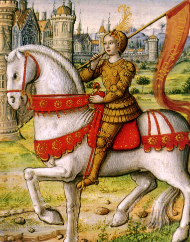 Joan of Arc, illustration from a 1505 manuscript, published 74 years after her death. Women rarely rode astride in the late Middle Ages and Early Modern Period -- the sidesaddle was considered more proper and no doubt conducive to the long skirts worn by women of the time. But on occasion, women could be admired for their daring and courage, as Joan of Arc was in France, if the end result was in the service of men. Women certainly rode horses with great skill, as in modern times, riding in hunts and on long pilgrimages. Geoffrey Chaucer's Wife of Bath, from The Canterbury Tales, may have been a critique on enterprising women, but she nevertheless represents a woman who bent society's rules, and got away with it.  Source: www.luminarium.org Even sidesaddle, women rode on hunts and in company with men. Clearly, galloping across rough country chasing hounds required a good seat, perhaps even better, in a sidesaddle. And other than the saddle itself, the horsemanship required was the same. 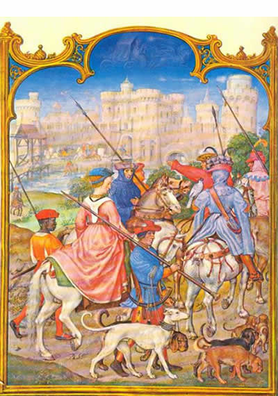 Illustration for the Month of August from Brevario Grimani, 16th century, Flemish. 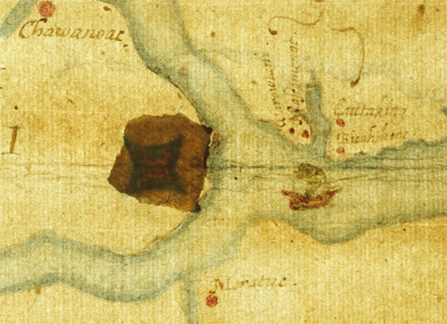
Detail from the Virginia Pars Map, drawn by John White c. 1587, showing fort-like structure under a patch contemporary with the map, at the head of Albemarle Sound, NC. Source: British Museum collection.
Last time, I suggested that the Lost Colony of Roanoke may have left the island for a location indicated by the Dare Stones. After additional research -- including examining the text of each known Dare Stone, where first discovered if known, and comparing that information with historical and geographical sources -- I have concluded that most of the Dare Stones, including the first one, are genuine and not fakes. [But see my July 29, 2015 entry.] Some, however, are clearly faked and the information and wording is either completely wrong or simply copied from previously discovered stones. These have served for almost 75 years to discredit the remaining stones, which are very convincing. If the believable Dare Stones are fakes also, they were created by experts in the field of 16th century English speech, Native American history, and the geography of North and South Carolina and northeastern Georgia, not to mention possessed of the complete list of names of the lost colonists.
That said, I believe the colonists divided into at least two groups shortly after John White, the governor and Eleanor Dare's father, returned to England in August, 1587, to obtain much needed supplies. The colony could not have arrived in the New World at a worse time and place. Although their official destination was the Chesapeake area in southeastern Virginia, their ships' captain put everyone ashore on Roanoke Island in eastern North Carolina. Claiming the weather was about to turn, but in reality wanting to prey on Spanish treasure vessels, he waited only long enough to unload the ships and take on fresh water before leaving with Governor White. The coast of North Carolina was experiencing the worst drought in 800 years, according to recent data from tree rings. So all the Native peoples were in turmoil, trying to guard their corn fields from raids by neighboring tribes. To the north, along the present-day Virginia - North Carolina border, the Powhatan Confederacy was forming under their chief of chiefs, Wahunsunacoc, known better to us as Powhatan, the father of Pocahontas. He imagined a great unified empire of Algonkian-speaking peoples, and the peoples of coastal NC were primarily Algonkian speakers, like the Croatoans. Manteo, a Croatoan who had traveled to England in 1584 and returned to his homeland, served as the colony's translator. He also tried to obtain adequate food for the colonists, but his people were a small tribe, and would not have had sufficient resources to feed 115 additional people during a severe drought. Worst of all, England was gearing up for a prolonged war with Spain, which would end only in late 1588 with the destruction of the Spanish Armada. No seaworthy ships could (or would) be spared by Queen Elizabeth to resupply the colony. They were stranded, in every sense. Documents and maps from the period, however, offer clues to the colonists' fate that have not been taken seriously up to now. The Virginia Pars Map, shown above, was re-examined in 2011 and found to have a fort-like structure covered under a mysterious "patch." The map was created by Eleanor Dare's father, John White, from observations he made while serving as naturalist and cartographer for the 1585-6 voyage to Roanoke, under Ralph Lane. As Lane's Narrative of the Settlement of Roanoke Island, 1585-1586 explains, the mainland at the head of Albemarle Sound was explored, as well as the lower reaches of the Chowan and Roanoke rivers. Located between the two rivers, the land rose into a hill now known as Merry Hill, NC, with excellent views of any ships approaching up Albemarle Sound. This is the exact spot marked with the "fort" on the Virginia Pars map. The extreme point of the hill is now a golf course, but the "fort" is located slightly to the southwest on the map. Lane describes the area thus, "Between Muscamunge and Choanoke upon the left hand as we passe thither, is a goodly high land, and there is a Towne . . . and hath a very goodly corne field belonging unto it: it is subject to Choanoke." Here, "at the head of the [Chowan] River in the place of my descent" Lane desired "to have raysed a sconse [small fort] with a small trench, and a pallisado upon the top of it." This would be only the first in a series of forts he recommended up both the Chowan and Roanoke rivers, and overland through central Virginia to avoid the Powhatan Confederacy, to reach both copper mines in the Appalachians and oyster beds in north Chesapeake Bay, where pearls were found in abundance. Like most English colonists, Lane saw North America as a land for the taking, rich with natural resources to be exploited for profit. The "savages," as Native Americans were called then, were just minor obstacles to be pushed aside if they showed any resistance. The Native peoples, however, were far more complex and sophisticated than Lane or any of the English could have imagined. Despite the drought, both the Croatoans on the coast and the Choanokes on the mainland showed generous hospitality and patience to the English. The Choanokes, particularly, were a numerous people and had prosperous villages all along the Chowan River basin. Their chief, Menatonon, remained friendly to the English even after Lane had taken him prisoner for two days, forced his people to pay a ransom, and then took his son hostage instead. Menatonon could reportedly put 700 warriors into the field from his main town alone, yet he refrained from showing hostility toward the greatly outnumbered English. So the point at Merry Hill was a likely spot for a future settlement -- it was defensible from the Spanish, it had good fields for growing food, it offered quick access to the supposed riches of the mainland, and it was protected (and initially supplied) by a powerful and friendly Native tribe. No wonder John White marked it on his map. Furthermore, it was about 60 miles "further up into the maine" from Roanoke Island. John White's Narrative of the 1587 Virginia Voyage puts the mileage at 50 instead of 60, but clearly he is not referring to the Chesapeake area, some 130 miles to the north. Why, for almost 100 years, has no one searched at Merry Hill for evidence of the Lost Colony? The first, and most credible, Dare Stone, dated 1591 and signed by Eleanor Dare, was found just 4 miles from Merry Hill, near Hwy. 17, not far from the site of the Choanoke town. The Roanoke River, on the west side of Merry Hill, leads directly upriver to the Occaneechi Path. Satellite images of Merry Hill, just southwest of the modern golf course, show what appears to be the outlines of a small fort, including a moat and extended gate wall, in the leveled soil of a plowed field.
We still have much to learn about the Lost Colony! While I agree that the main body of the colonists were intended for the Chesapeake, and probably all moved to Croatoan for the winter of 1587, as the "CROATOAN" sign famously suggests, I believe a number of colonists also went to Merry Hill in 1588, as the first Dare Stone claims. If so, it would prove to be only a stopping point on Eleanor Dare's amazing journey into America. Next time, I'll take a closer look at the Occaneechi people for whom the trading path is named.
 Source: NC Encyclopedia at ncpedia.org
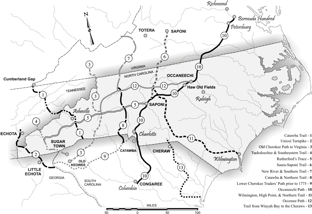
What happened to the English colonists of the ill-fated Lost Colony on Roanoke Island? Theories spring up like crocus in a lawn, only to vanish in the heat of closer examination. The Dare Stones, once considered to be entirely faked, have recently been brought to light again through the controversial TV series America Unearthed episode "Mystery of Roanoke." What is interesting to me about the Dare Stones is the lengths to which people will go to defend their pet theory, rather than investigate to uncover the truth. Just to go on record from the beginning, I'm not at all persuaded that most of the Dare Stones are real. In fact, I think most of them are fakes. But I find the original and a few of the later Dare Stones to be compelling and worthy of further examination. My reason for this rests partly on the trajectory of the Occaneechi Path. The Dare Stones imply that Eleanor Dare (daughter of Governor John White) and a few surviving colonists went southwest, away from the coast of North Carolina and deep into South Carolina and even western Georgia. On the surface of it, this theory sounds preposterous. Why would the remnants of the colony and possibly also a few surviving Croatoan Indians go in that direction? How would they even get to Georgia through hundreds of miles of dense forest and numerous river crossings? The Occaneechi, or Great Trading, Path provides an answer. It began on the James River in Virginia and headed southwest to the Roanoke River near the Virginia - North Carolina border. There, on an island in the river, the Occaneechee Indians held their place as great traders along the upper portion of the Path. (The Roanoke River empties into Albemarle Sound farther east, in coastal NC, not far from where Roanoke Island and Croatoan Island lie at the mouth of the sound.) After leaving the coastal plain, the Path pushed westerly through forests and across more rivers to what is now Asheboro, NC, then headed more southerly toward Charlotte, NC. From there, it split into an eastern branch that led to Columbia, South Carolina, and a western branch called the Lower Cherokee Trading Path, which ended near Little Echota, in Georgia. John Lederer, one of the first explorers of the Carolina backcountry, clearly notes the Path on his map from the 1670s, so we know it was in use before his time, and probably for centuries prior. The Native peoples were sophisticated traders and travelers, as their own stories and beliefs attest, and numerous archaeological finds have demonstrated. Thus, there is some logic in the theory that Algonquin Indians from Croatoan, having befriended the English camped on Roanoke, might have led them to safety among their trading contacts in the west, the powerful Itsate Creek people living in northeastern Georgia [not Cherokee before 1700s]. This is precisely where some of the Dare Stones say Eleanor Dare went. Coincidence? Or a clever hoax? Let me know what you think. In my next post for "Dare to Follow," I'll explore some theories on what caused the English to vanish from Roanoke Island. 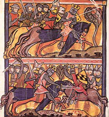 The real medieval warhorse was maneuverable and relatively small, but packed a strong punch. Read The Warhorse, 1250 - 1600 by Ann Hyland and see the Destrier site.
Victor, the warhorse in my screenplay, is part Friesian and part Neopolitan (not unlike the modern-day Lippizan). Take a look at the most developed form of classical cavalry movements as performed by the Spanish Riding School in Vienna, Austria. At the beginning of the sixteenth century, the partnership between horse and man was just being discovered. Ironically, even as gunpowder, cannon, and small arms were changing warfare forever, horse training was evolving into an art form that could produce the most sophisticated warhorses ever seen. The character of Margit illustrates both this new, humane relationship with horses and the emergence of women as skilled horse handlers in early modern Europe. Yet, despite a century of female leadership in riding and training, it was not until 2008 that the Spanish Riding School broke with tradition and accepted women into it's performance program. |